Saskatchewan GPS Maps

For Garmin GPS Units
$9995

Type
Format

✔️ Best for: hunting, ATVing, snowmobiling, overlanding, remote fishing trips and backcountry exploring.

Barcode: 6-22098-00233-1

MicroSD Card VS Digital License

PLUG & PLAY MicroSD Card

  • Plug & Play Installation: Simply insert the card into your Garmin GPS unit, and you're ready to go!
  • Card Size: Pre Programmed on 8, 16 or 32GB microSD card. Our GPS maps occupy up to 2GB of space on the SD card.
  • Coverage: Single Province or Pre Built Combo Maps
  • SD Card Adapter: The maps are stored on a microSD card. The packaging includes an SD card adapter for older units.

DIGITAL LICENSE

  • Immediate Installation: After your purchase, you can download the maps and install them on your device right away using Garmin Basecamp. No shipping required.
  • Coverage: Customizable Maps, Build and combine maps the way you need.
  • Compatible with Garmin Smartwatches: Install our maps on your new Fenix, Descent, MARQ, or other Garmin smartwatches. Check the list for compatible models.

Map Coverage and Version Summary

Scale: Dynamic Scale
Version: V2027

Covering Province of Saskatchewan these GPS Maps are the most detailed, comprehensive and up-to-date GPS maps available on the market.

BONUS App access

Includes free access to the BRMB Maps smartphone App and Web Map. (limited time)

More Backroads. More Trails.More to Explore.

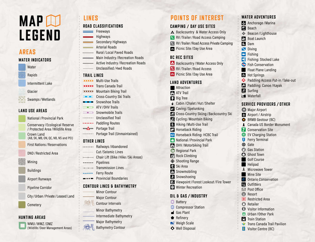
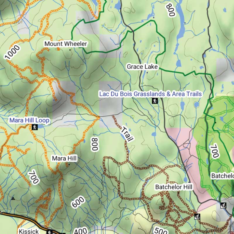
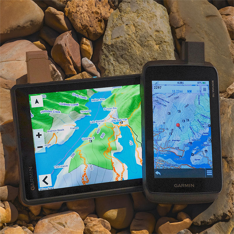
Get detailed backcountry maps for your Garmin GPS, covering areas that regular road maps miss. Explore remote backroads, ATV and snowmobile trails, hunting zones, and Crown and Private land.

Backroads & Land Information

Forest service roads, resource roads, topography, Crown and private land information.

Trails, Hunting & Recreation POI

ATV and snowmobile routes, hunting areas, fishing lakes, campsites and outdoor points of interest.

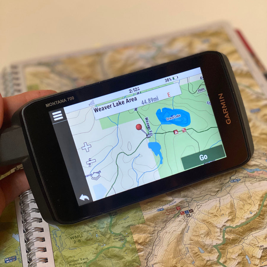
Works Offline on Compatible Garmin GPS Units

Offline maps stored on your Garmin, ready to use without cell service or phone battery concerns.

Saskatchewan GPS Maps Features

Coverage and Versions

Included in Saskatchewan GPS Maps V2027

Explore Saskatchewan from prairie roads and parkland to northern forests, lakes and rivers with detailed GPS mapping for compatible Garmin devices. The 2027 edition combines routable roads with trails, paddling routes, recreation sites, geographic features and extensive resource data.

What’s new in the 2027 edition

  • Almost 2,000 km of newly added roads and more than 1,700 upgraded or newly named roads
  • More than 2,000 km of added trails, including multi-use, paddling and snowmobile routes
  • 100+ new trailheads and staging areas
  • More than 115,000 new resource sites, plus new battery, disposal and wind turbine data
  • Almost 4,000 new recreation and geographic features
  • 1,150+ new fishing waters, 560+ parks, 520+ backroad attractions and nearly 200 private campsites

Map features

  • Province-wide Saskatchewan coverage from the southern prairies to the northern wilderness
  • Searchable roads, trails, recreation sites, geographic features and resource locations
  • Fishing waters, parks, campgrounds, overland routes, winter recreation and paddling access
  • Supplied on an 8, 16 or 32 GB microSD card for compatible Garmin GPS devices (digital download also available)

Land Information, Roads, and Trails

Land & Hunting Information

Explore Saskatchewan's Crown land, private land information, Wildlife Management Zones, hunting areas, national and provincial parks, conservation sites and other protected lands. Topographic and geographic information covers prairie landscapes, boreal forests, lake country and remote northern wilderness.

Roads & Backcountry Access

  • 264,129 km of routable roads, plus 57,916 km of non-routable road data.
  • V2027 adds 1,700+ km of routable roads, alongside improvements to more than 1,700 road names and classifications.
  • Includes highways, rural roads, forestry and resource roads, logging roads, industrial routes and remote backcountry access.

Trails & Outdoor Recreation

  • 12,302 km of snowmobile routes
  • 4,229 km of ATV routes
  • 2,619 km of multi-use trails
  • 8,862 km of paddling routes
  • V2027 includes 2,000+ km of added or updated trails and routes, plus over 100 new trailheads and staging areas.

Additional recreation information includes fishing waters, campgrounds, parks, boat launches, overland routes and access points throughout Saskatchewan.

Adventure Points of Interest

Backroad Extras are where you find all the POI information specific to our Backroad GPS Maps.

Unique to BRMB’s Saskatchewan GPS Maps are feature POI sets of over 1.2 million searchable points including Oil and Gas Township Quarter Section Grid Locations, Compressor Stations, Gas Plants, other Resource Facilities and Backroad POI sets.

Note: Backroad POIs can be searched by selecting the Where To/Find > Extras and then Go! option, or read what each site offers through the More option.

Oil and Gas Resource Facilities can be searched by selecting Where To/Find > Cities and then by entering the full Grid reference for Facilities. For Saskatchewan facilities enter the Township Quarter Section Grid Reference (ex: NE-07-124-23-3, SE-27-24-15-W).

Custom POI Highlights

  • Over 1.2 million searchable Oil and Gas Township Section and Quarter Section Grid locations
  • 196 Compressor Stations
  • 34 Gas Plants
  • 2,908 Resource Facilities
  • 117,047 Wellsites
  • 101 Hunting Areas and 267 Hunting LEH Areas
  • Fishing Lakes and Rivers with 2,032 locations with descriptions and fish species
  • 370 Boat Launch locations
  • 606 Trails with front country and backcountry locations and descriptions
  • ATV Trails with 54 locations
  • Snowmobile Routes with 245 locations
  • Parks with 765 National, Provincial, Regional and other park locations
  • Recreation Sites with 97 locations and descriptions
  • 121 Backcountry campsites
  • 275 Campsites and 75 Picnic Areas
  • 136 Paddling Routes, 166 Access Locations and 713 Portage Locations
  • Wildlife Viewing with 191 locations and descriptions
  • 98 Winter Recreation Sites
  • 7 Ski Areas
  • 2,340 City, Town and Community locations
  • Over 11,000 searchable land and water geographic features


Backroad GPS Maps Categories

Backroad Attractions • ATV-OHV Trails • Backcountry Camps • Boat Launches • Border Monuments • Campsites • Cities • Compressor Stations (found under city search) • Fishing Lakes, Rivers, Streams • Gas Plants (found under city search) • Gates • Golf Courses • Hunting Areas • Huts • Land Features • Lodging • Marinas • Oil and Gas Township Quarter Section Grid Locations (found under city search) • Paddling Access • Paddling Routes • Parks – Provincial – National - Urban • Picnic Areas • Portage Locations • Public Services • Recreation Sites • Resource Facilities (found under city search) • Rivers and Creeks • Ski Areas • Snowmobile Routes • Trails • Transportation Services • Visitor Information • Water Features • Waterfalls • Wildlife Viewing • Winter Recreation

Map Format & Compatibility

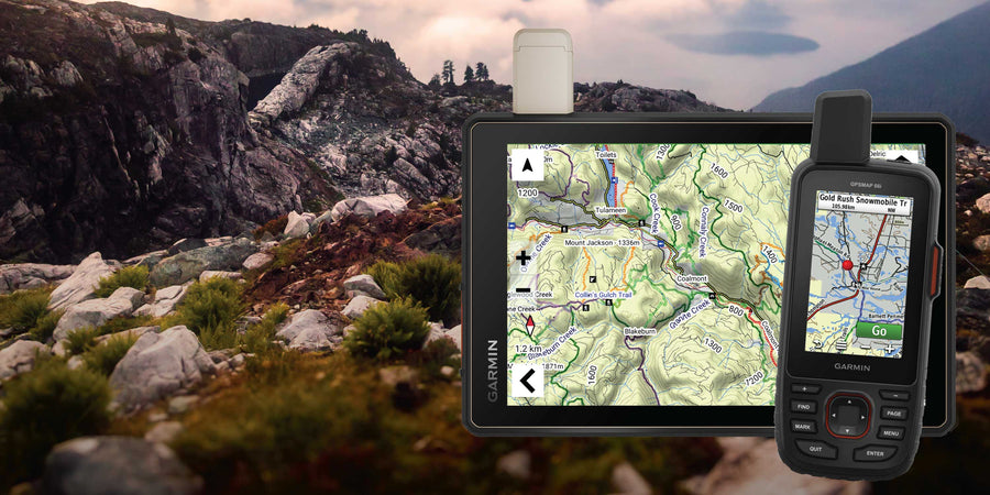
Our Backroad GPS Maps are designed to be compatible with most Garmin GPS Vehicle or Outdoor models made in 2012 and later that accept SD or Micro-SD cards.

However, it’s important to note that some units may experience issues with display or feature availability, depending on the model version.

You can check if your unit is compatible here.

Map Format

  • Preloaded on an 8, 16 or 33 GB microSD card for easy installation (digital download also available)
  • Seamless topographic mapping at 1:20,000 and 1:50,000 base scales
  • Shaded relief and 3D views on supported Garmin devices

Overall rating: 1.0 / 5 from 1 reviews.

AI Generated Review Summary

Summary topics

Review topics: [].

Review highlights

Reviews

The SD card was corrupted

"The SD card was corrupted when I received the product and would not load into my Garmin GPS device. I have been attempting to contact Backroad Mapbooks by email for the past three weeks to resolve the issue, but I have not received any response. The customer service experience to date has been very disappointing."

— Norm F. (1/5)

Q&A

Saskatchewan GPS Maps 2027 Garmin GPS map product

Saskatchewan GPS Maps

From $9995
Explore Saskatchewan from prairie roads and parkland to northern forests, lakes and rivers with detailed GPS mapping for compatible Garmin devices. The 2027 edition combines routable roads with trails, paddling routes, recreation sites, geographic features and extensive resource data. What’s new in the 2027 edition Almost 2,000 km of newly...

Scale

Dynamic Scale (Digital Map)

Area

Province of Saskatchewan

Dimensions

Micro SD card

Pages

n/a

Release

2027

Features

Routable roads; ATV, snowmobile, multi-use and paddling routes; trailheads and staging areas; fishing waters; parks; private campgrounds; overland routes; resource data

Type

  • New License
  • Map Update

Format

  • 8GB SD Card
  • 16GB SD Card
  • 32GB SD Card
  • Digital-Only (No SD Card)
  • Update File Only (Downloadable)
View product